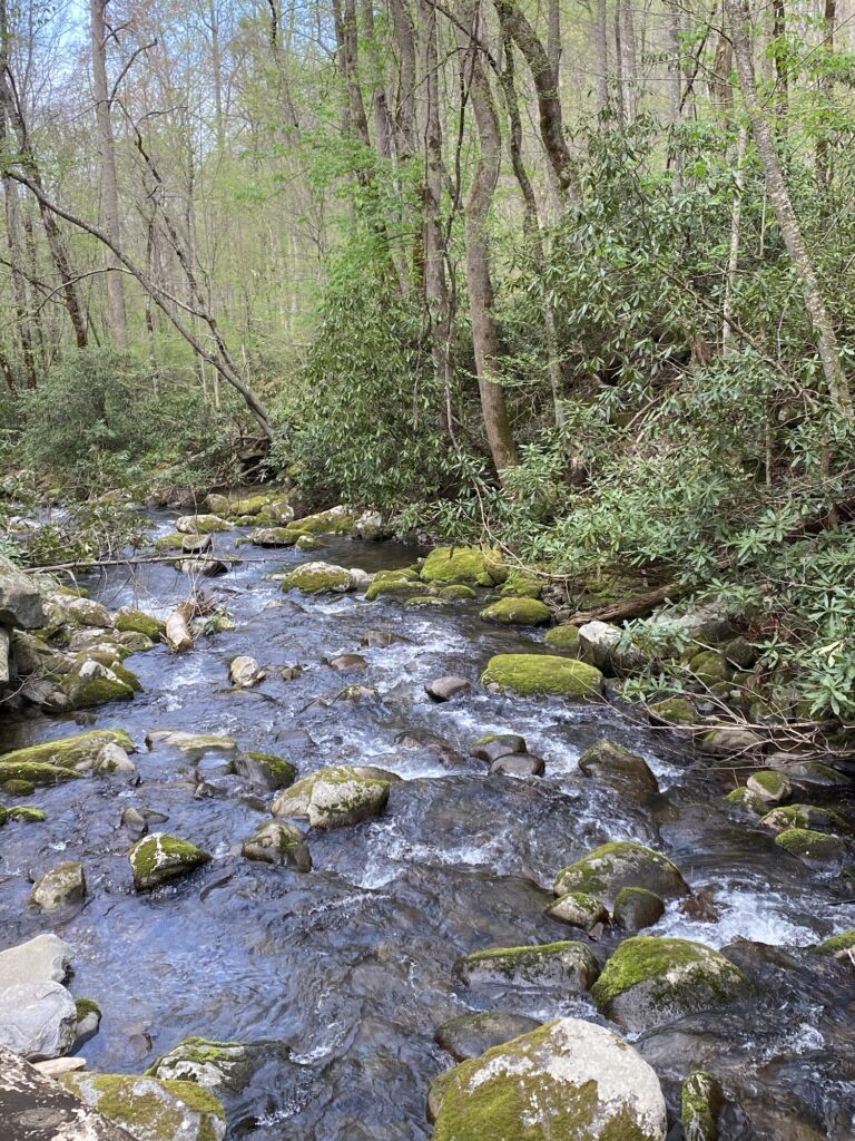
After leaving Huntsville, Alabama, we headed into some very pretty, green deciduous forests. First off some NARROW crazy state highways, but finally back on I40. So many colors of green since these trees are just leafing out and it rained – beautiful! We passed through Tennessee and then a quick touch through Georgia and then back to Tennessee. Then we headed southeast to get to Maryville and Townsend, Tn. We stayed in Cade’s Cove campground inside the park. Almost the entire way was green forest but as we got to the middle of Tennessee it did start to look more agricultural, more cattle and pig farms. You can envision how hard it was to clear this land to grow pastures away from the trees. We liked the campground aside from the fact that we were in a loop that allowed generators, and boy did people run them!
Cade’s Cove is a valley surrounded by the Great Smoky Mountains. It is about 1,000 ft elevation and basically was part of the early settlement region in the area. We went to Maryville to do laundry and also happened to find Bruster’s ice cream- they had a store near one of the apartments Cherie lived in in Atlanta. Good times. And very tasty. We also had dinner one night in Townsend- a place called Peaceful Side Social Brewery and Kitchen. And it turns out, creamery. What a truly cool place, and again very tasty food. Townsend is in what is referred to as Peaceful Valley, which is what the original Cherokee tribes called it. That was before they were marched out on the Trail of Tears to the Oklahoma territory. Somewhere around 40-50 members of the tribe managed to escape the forced march and hid out in the mountains for over 30 years without being discovered. They were given some land that borders the park and there is a town called Cherokee right on the Blue Ridge parkway. We didn’t get there since it was on the far side of the park from us.
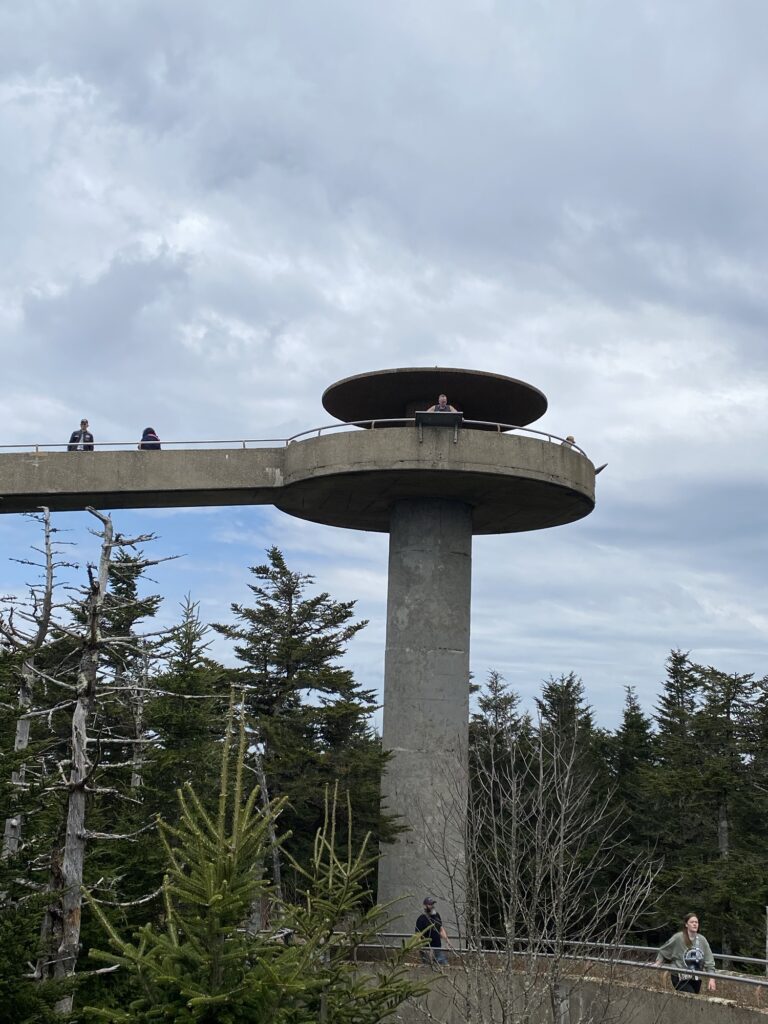
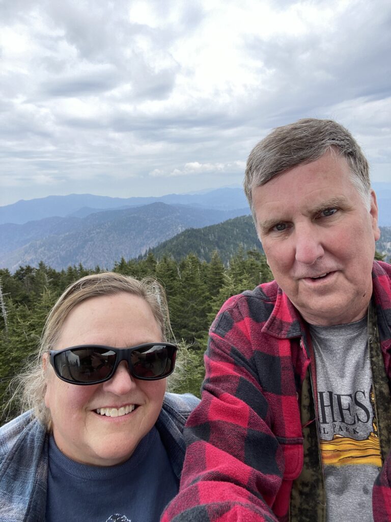
Like most national parks, Smoky Mountains is big and requires a lot of driving to get around. We didn’t get to the northernmost areas but we did make it to Clingman’s Dome which is the highest point in the range. There is a structure there that on a clear day allows you to see into 7 different states! It wasn’t clear the day we made the hike which was probably good for me- 600 ft almost straight up in a half mile. At altitude. I thought I might pass out once but we very slowly made it up. There were two sisters walking up whom we passed, at least late 70s, heavily using walking sticks who had been there before, so I couldn’t quit!! Then at the top, it was so high I could barely move. I wish I was braver about heights but nope. I did manage to grimace for a selfie and we headed back down. Down is faster, but hard on the knees. That trail was just damn steep!
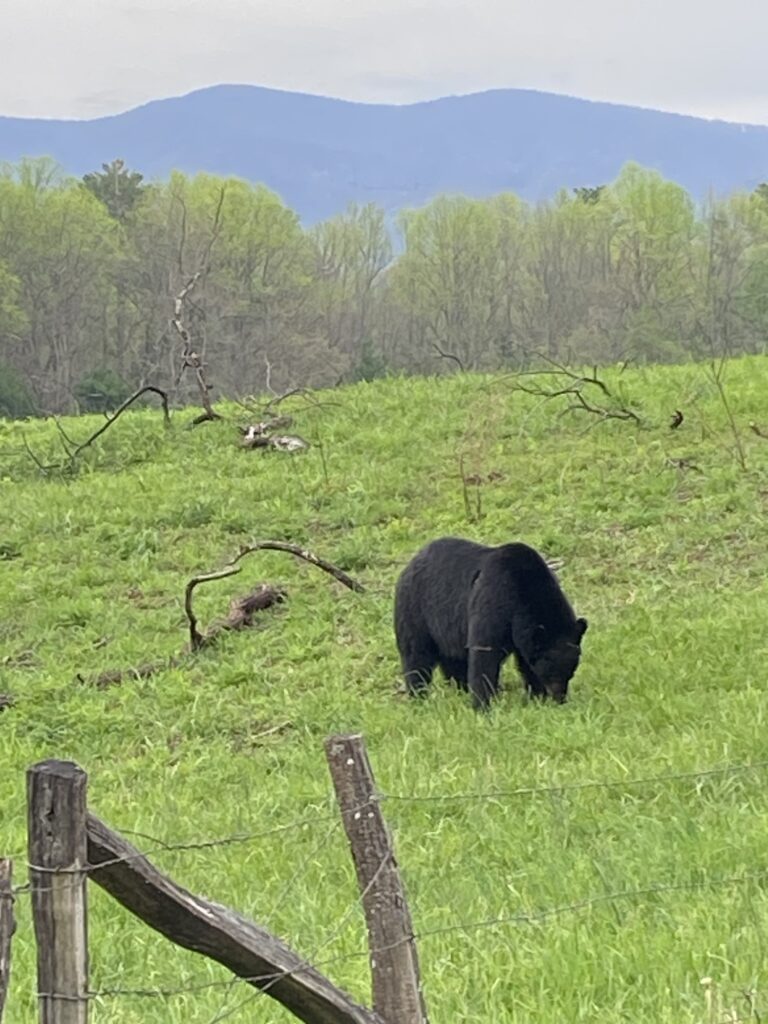
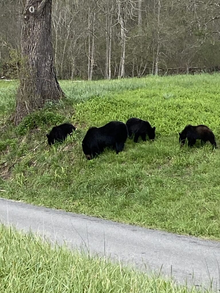
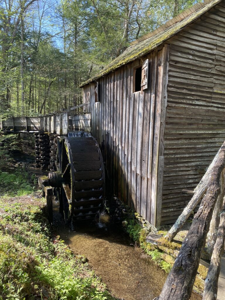
My favorite part of the GSM was the Cade’s Cove loop- an 11 mile drive through some early settlement areas (old churches and a grist mill) and the home to at least 5 black bears. And a coyote, white tail deer, lots of turkeys, a cottontail and a Barred owl. Probably more but that’s all we saw in 4 loops around the cove. It is a single lane almost all of the loop and the bear jams get pretty massive! The first evening we mostly saw a coyote and the mama bear with cubs way back in the trees. And had to laugh at how excited people were to see wild turkeys (come by any time y’all cuz we got those daily in our backyard!). The next morning we saw a good sized male bear (they are 100-200 pounds smaller than our black bears) just crunching black walnuts right on the side of the road. We got a primo spot right across from him in the junction spot with a closed road. It was amazing to see him just smash a walnut shell with his molars, and then spit out the shells. I think we were there about 40 minutes total, just hogging up the perfect placement. Oops. Then as we traveled the rest of the loop, we saw some deer and the owl. That afternoon after trying to die on Clingman’s dome trail, we saw the bear sow and her 3 cubs ( 14-15 month olds) at the same walnut tree, just munching on those walnut shells. The cubs could crunch them, very loudly, but had some issues spitting out the shells. We did find an almost white turkey hen in a field which was pretty interesting. And we finally got to the visitor’s center and walked through the old lumber buildings and the gristmill. Interesting to see how innovative these people were to stay alive and well.

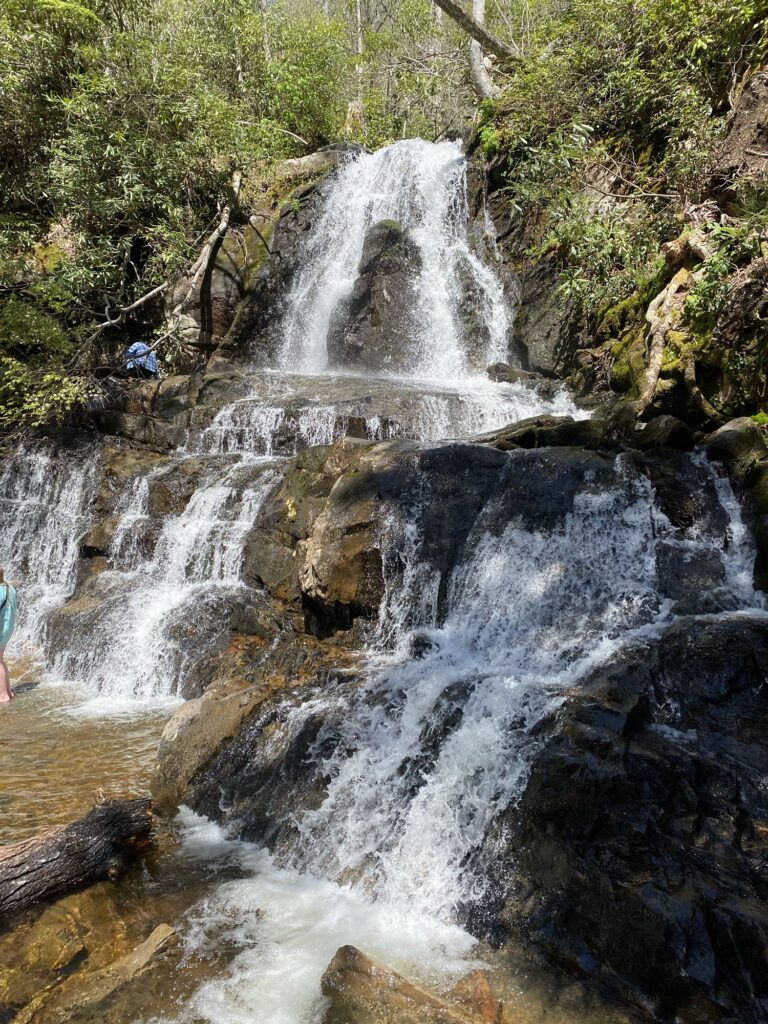
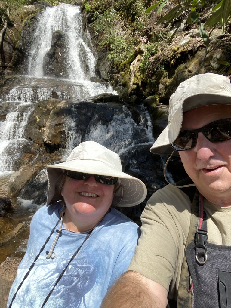
Our last day we decided to go to Laurel’s waterfalls, along with the rest of the park, it seemed. We had to park a quarter mile from the trail and go uphill to the trailhead. Not a good start for me! Then as we are walking up, a bus of MIDDLE SCHOOLERS gets off the bus to go up the trail. They were faster than us at least. And the trail was again – up but not quite as steep. 450 feet in 1.2 miles. Gaaa…. And not as much altitude but very sunny. But I made it (yes, so did Dave!) 🤣, and it was pretty. It made us realize how truly spoiled we are in California. All that hiking and it was a small Sierra waterfall, basically. Yosemite falls anyone? Also, we are spoiled because we’ve seen so much beautiful country already. But, we made it back down and naturally made another loop around Cade’s Cove!
All in all a fun trip to Great Smoky Mountains National Park, with a good campground and lots of bears! Don’t know if we’ll ever get back here and I’m glad we came! As always, link to Dave’s pictures for much better shots of what I have here taken with just my phone!