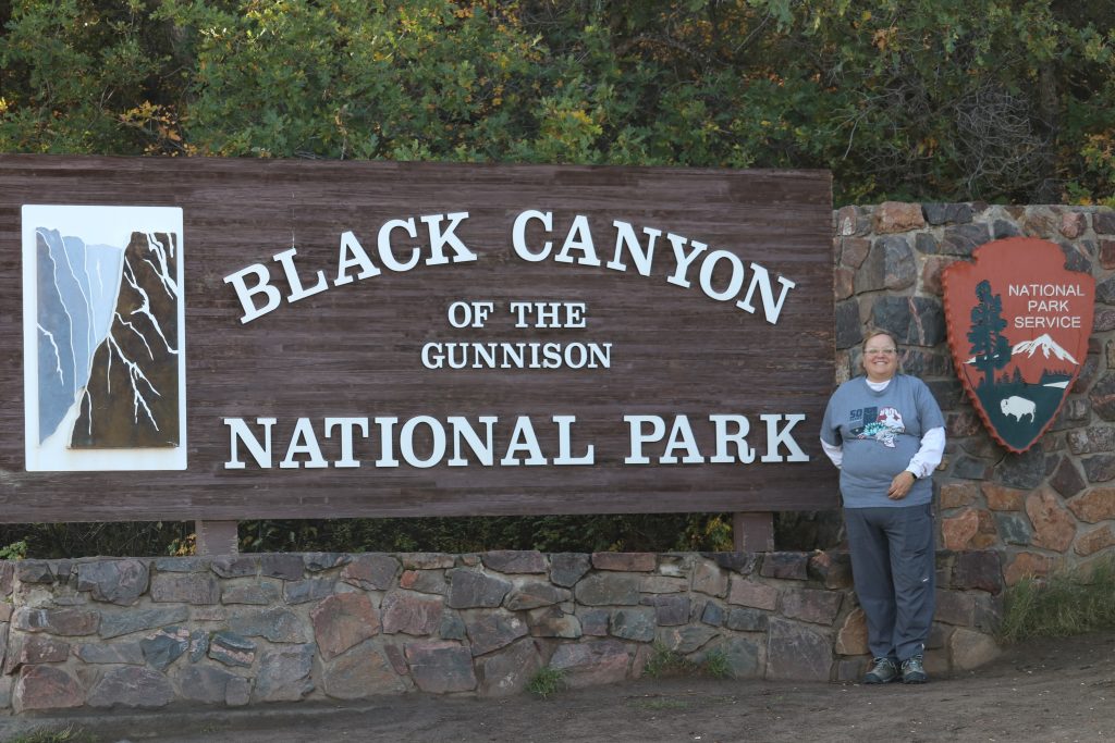
This was our last park of September. This park is where Cherie and Eric got engaged, and where the RAV4 lost its alternator. We had never been here so we thought we’d try it. You have to go through the Curecanti Recreational Area and it was so beautiful. Big lakes and obviously a lot of fishing and hunting tourism around there.
To get to Black Canyon, you have to get back to the west side of the Rocky Mountains. On Highway 50, of all things. It is very pretty country as you approach he mountains from the east; you leave the high plains/ sage desert, and go up and up. And further up! As you now descend the mountains on the western side, you get back into the desert-type conditions but no plains grasses. We had a small herd of Bighorn cross in front of us as we passed a beautiful lake. We also got stuck in about an hour of construction as we started down the mountain. They are building and widening Highway 50 we think, and it is right through a pass. So they have to shut down the entire highway, scurry around to move massive blocks and rocks, then clean up to let one way or the other of the traffic through. Then repeat. Luckily, since we have King Tut, we just had lunch and walked around during the wait. Then we headed to the Montrose, Co, KOA. It was an ok KOA but we were a bit bummed the laundry facilities were unusable. But then luck- as we went to a pretty nice laundromat, we found a Freddy’s Steakburgers and frozen custard place. Cherie and Eric introduced us to this on our visit to Dinosaur National Monument. It was very tasty indeed. So something good came out of having to do laundry!!
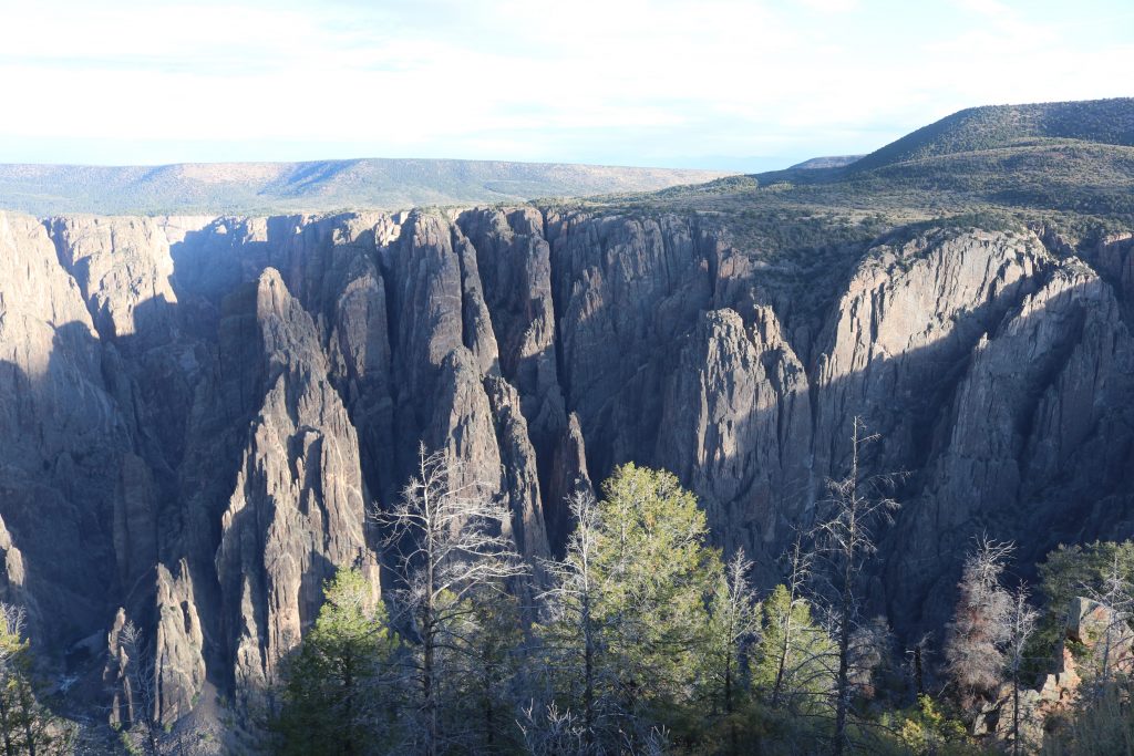
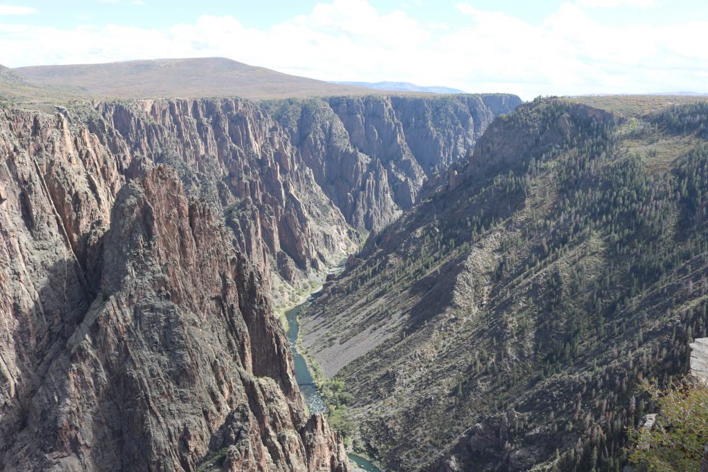
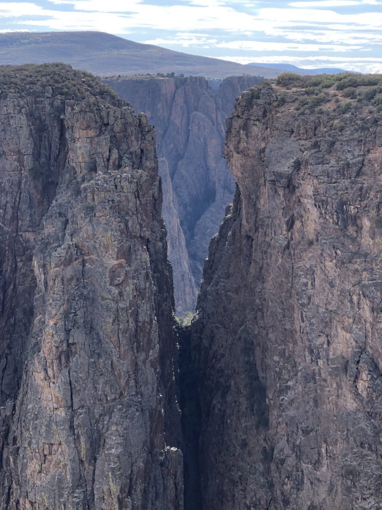
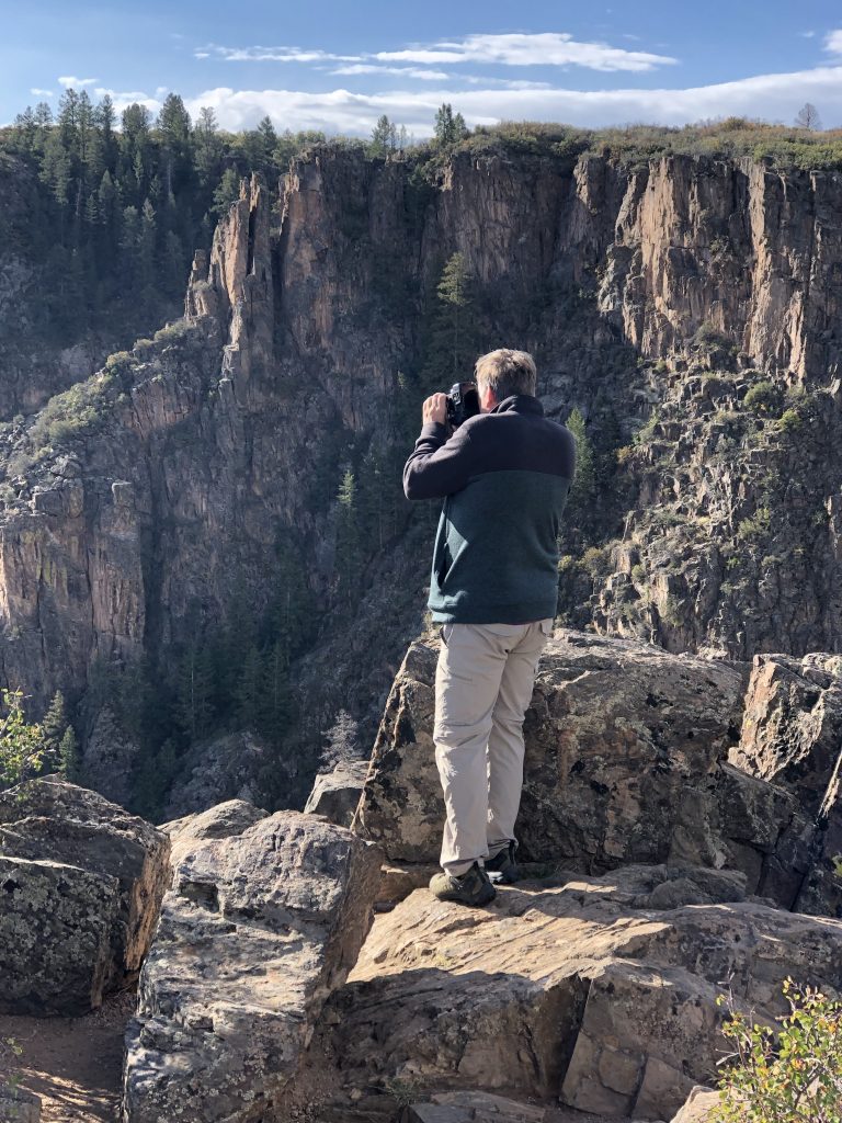
Black Canyon is extremely impressive because it is very narrow, carved out of the rock by the Gunnison River. It has the tallest steep side of any canyon in the US according to them. There were several warnings that every year people die climbing the rock, and often their body is never reclaimed because of the gorges and cracks in the rock. It was a bit unfortunate that we were having stormy weather during our visit, so it was a lot of go for 4-5 hours and head back to the rig. There scenic road had quite a few short walks to the edges so we got a lot done. We went on one decent hike on the Warner Point Trail but barely made it back as the rain was falling. Since many of the storms had lightning associated with them, we were not going out onto cliff edges during that!
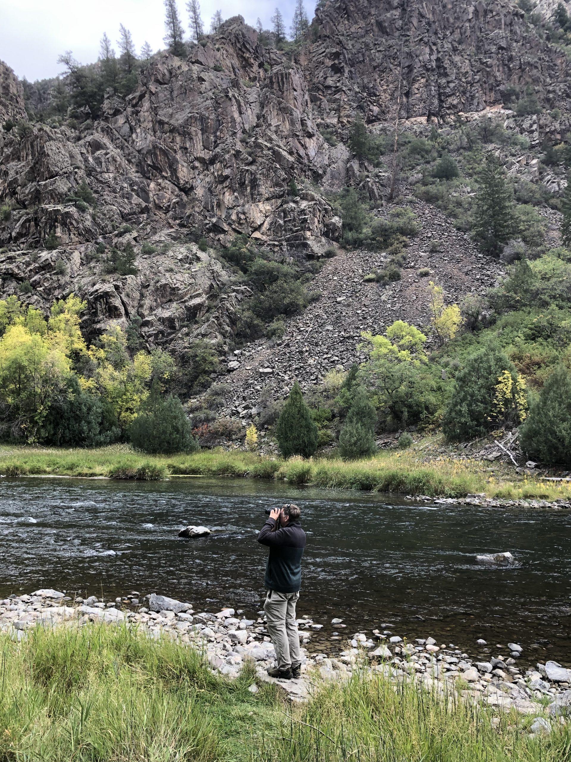
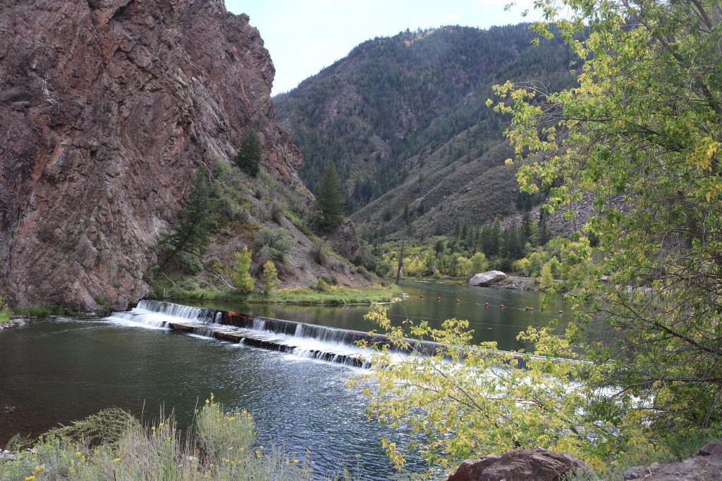
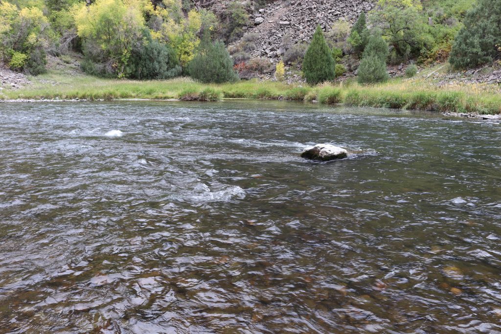
on a whim, we decided to see what the East Portal Road was – it comes off the main park road, right as you pass the gate. We thought it might be an entrance and found that it ends on a dam that has no access. It takes you all the way down to the Gunnison River and was so spectacular. We had lunch down there and walked the river a bit. There is a small campground there with vault toilets and very limited support but man, was it beautiful!
So this park was a 2 dayer – unless you are climbing there aren’t really good trails. But so pretty. We missed the peregrine falcons and cranes since they had all headed south already. I don’t know if we will go back, but we thought the park and Montrose itself were nice.